The Northern Territory is the most barren of all areas in the whole of Australia. It encapsulates a total area of 1.35 million square kilometres and accounts for 20% of the whole country. However, only around 226,000 or 1% of Australia's population lives here.
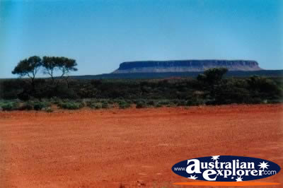
Red is the predominant colour found in the soil, the rocks and Uluru (Ayers Rock) which are all situated in Central Australia (also known as the Red Centre). Surrounding the centre are a number of meteorite crators, canyons and valleys.
The Stuart Highway is the main road that leads from Darwin to Alice Springs and is packed with many interesting places. Darwin is a large cosmopolitan city in the far north. Watch out for the thunder, they have on average over 90 days of it a year!!
 The centre is extremely arid, with greatly varying temperaturers. Further north the region is dry between April and September, and wet between October and March. It is often best to visit the region during the wet season because everything is green and there is no dust. Although the humidity and temperatures are high.
 Far North Northern Territory (the Top End) is home to the vast Arnhem Land which is Aboriginal land, as well as the Kakadu National Park. Just off of the Northern Territory coast are the Tiwi Islands, home to the Tiwi people.
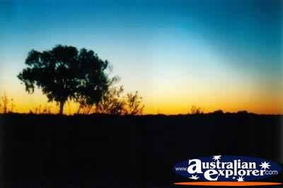
 Further south the Stuart Highway leads through Katherine all the way to Adelaide in South Australia. Along the journey south between the Top End and Central Australia through the Middle of Northern Territory, the harsh reality of the Australian Outback really hits you. The towns are far apart, the roads are dusty and it is a great way to experience Australia.
A Little History
The Northern Territory was previously controlled by both New South Wales and South Australia. In 1911 the Federal Government took control leading to self government in 1978, although Canberra still holds much authority over its internal affairs.
Points of Interest
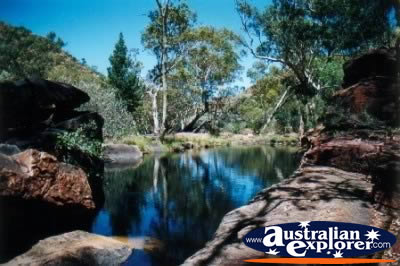
 Kakadu National Parkis an oasis of waterfalls, wildlife and aboroginal rock art.
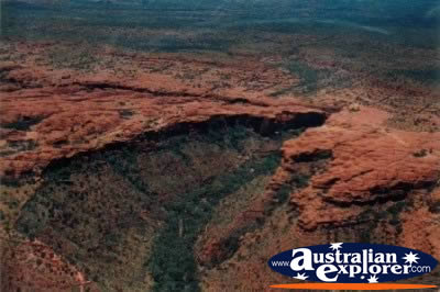
Uluru-Kata Tjuta National Park - This famous location makes for unforgetable sunsets and sunrises over Uluru and the Olgas - don't miss it!
Kings Canyon is a remarkable canyon set amid the harsh outback landscape.
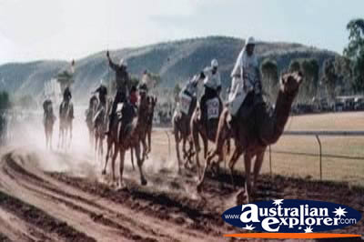 Camel Racing is a popular sport in the Northern Territory, started in the 1970s after a bet between two friends. Since then, Camel Racing, has become a regular attraction at annual celebrations in the area.
Camels are known for their unpredictable temperament which proves to be very entertaining in a racing environment.
While they can run speeds of over 60km/hour, upon the start of the race some camels choose to stay firmly at the line, others take off slowly while some even prefer to go backwards - to the rider's dismay and the spectactor's enjoyment.
The Camel Cup is a popular event in the Northern Territory which draws huge crowds. Held annually, the festival incoprporates fun rides, great food and drink stalls, live music, belly dancers and more. Throughout the day there are a variety of races including kids races, rickshaw races and even a novelty relay-style race with appropriately dressed "brides" and "grooms." The offical feature race is called the "Imparja Camel Cup" where the winning camel rider and it's owner are presented with the trophy.
The Camel Cup is held at the Blatherskite Park which can be reached by car or free buses from the Post Office and Council Chambers bus stops.
Northern Territory Facts
* Northern Territory Area: 1,346,200 square kilometres
* Northern Territory Capital: Darwin
NT, NT Accommodation
Top Northern Territory Destinations
| Darwin |
Middle |
Red Centre |
| Top End |
| Alice Springs |
Arnhem Land |
Ayers Rock |
| Eastern MacDonnell Ranges |
Kakadu |
Kata Tjuta |
| Katherine |
Kings Canyon |
Tennant Creek |
| Tiwi Islands |
Uluru |
Western MacDonnell Ranges |
Other Northern Territory Destinations
| SHARE with |